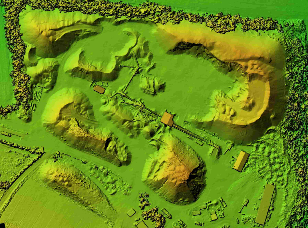
photogrammetryAcoustic Compliance Australia performs photogrammetry by utilising drones to capture thousands of photos of clients sites which are then meshed together to build realistic 3D models. Our CASA accredited operators fly drones in accordance with the simplified Civil Aviation Safety Regulations Part 101 which is applicable to drones.
Photogrammetry allows us to more efficiently construct client facilities in 3D rather than manually constructing each component. photogrammetry provides
|
Lidar
Light Detection and Ranging (Lidar) is utilised by Acoustic Compliance Australia to obtain photo realistic 3D models of client assets for inclusion into noise modelling software.
By incorporating these 3D assets into our noise models, we can more efficiently communicate what plant item is being discussed, highlight where issues are occurring and provide a more accurate representation of the asset in presentations.
By incorporating these 3D assets into our noise models, we can more efficiently communicate what plant item is being discussed, highlight where issues are occurring and provide a more accurate representation of the asset in presentations.
To see this in practice, the below two videos demonstrate the capturing process as well as the final result.
|
|
|
Lidar allows us to obtain the following
|
What is photogrammetry
Acoustic Compliance Australia performs photogrammetry by utilising drones to capture thousands of photos of clients sites which are then meshed together to build realistic 3D models. Our CASA accredited operators fly drones in accordance with the simplified Civil Aviation Safety Regulations Part 101 which is applicable to drones.
Photogrammetry allows us to more efficiently construct client facilities in 3D rather than manually constructing each component.
Photogrammetry allows us to more efficiently construct client facilities in 3D rather than manually constructing each component.
photogrammetry provides the Following
- Topographical data
- Structure locations, dimensions and elevations
- Photo realistic 3D models
- Ability to calculate volumes and surface areas
What is Lidar
Light Detection and Ranging (Lidar) is utilised by Acoustic Compliance Australia to obtain photo realistic 3D models of client assets for inclusion into noise modelling software.
By incorporating these 3D assets into our noise models, we can more efficiently communicate what plant item is being discussed, highlight where issues are occurring and provide a more accurate representation of the asset in presentations.
By incorporating these 3D assets into our noise models, we can more efficiently communicate what plant item is being discussed, highlight where issues are occurring and provide a more accurate representation of the asset in presentations.
To see this in practice, the below two videos demonstrate the capturing process as well as the final result.
Lidar Provides
- Asset dimensions
- Photo realistic 3D models
- Ability to inspect assets from any direction


